general description
Melrose creek and the Don river flow through the undulating property and there is a small lake as a central feature.
Trees and shrubs are planted in groups according to their geographical origins. There is a good collection of Tasmanian species and also Gondwanan descendent species related to Tasmanian flora. Other temperate areas of the world represented are New Zealand, South America, North America, Europe, the Mediterranean and Eastern Asia.
The collection of 27 Tasmanian native eucalyptus planted in 1990 enhance a fine collection of native trees and shrubs, with interpretative labelling, the park provides a living tree reference in addition to a peaceful countryside which delights visitors.
The lake with settling pond, inlet canal with 2 weirs, 2 islands, the bridges enable visitors to walk across and enjoy the platypus, swans and other wildlife.
The propagation nursery was built in 1990/91 and includes a glasshouse, covered growing area, shade house, a building for potting, a workroom and office used by volunteer workers.
There are several limestone outcrops and remnant lowland vegetation.

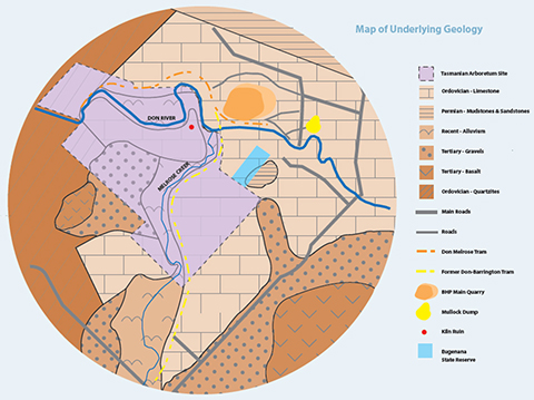
geology of the area
The nearby Eugenana State Reserve contains the best exposure of the Eugenana Beds, the only known dated example of an ancient "fossil" limestone cave system.
The Eugenana Beds consist of sandstones, carbonaceous siltstones and rubble from cave collapses. The sediments and rubble have been interpreted as representing five stages in the development, infilling and final collapse and closing of a limestone cave system.
These beds are a complex of Ordovician [510 to 440 million years ago (MYA)] Gordon Group limestone. The Ordovician was a period when most life was oceanic. Terrestrial life only emerged at the end of the period. The limestone laid down at that time was from the bodies of invertebrates. When you consider the huge areas of the earth covered by limestone from this period, and the depth of the coverage limestone from this period [up to 600 m at Gunns Plains], you can get an idea of the number of animals that died over the 70 million years of the Ordovician period.
Commencing in the Middle Devonian (370-380 MYA) widespread earth movement severely affected the region, deforming the originally horizontal sedimentary rocks into folds, and causing movement along faults. It was the last of the great geological upheavals that left Tasmania basically in the geophysical form it is today.
Only in the Eugenana area is confirmation of surface or near surface conditions as they were during the major period of folding and mountain building exposed. Found here is the best understood and only dated paleokarst [ancient limestone landform] site in Tasmania, which together with its importance in helping to date this great geological upheaval, known as the Tabberabberan Orogeny, makes it of major significance as a reference site.

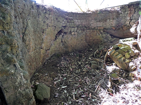
The remanant lime burning pit on Limestone Hill
lime manufacture
Beginning in 1862, lime burning was conducted in a kiln above a hand dug pit, with the lime probably first transported out by bullock teams.
The round kiln was the most modern technology for the time. Its remanants can still be seen. The limestone was quarried from above the kiln and timber for fuel came from the surrounding forest. In later years nearby limestone caves became a small tourist attraction.
Use of the lime in the making of mortar may have occurred as far away as Stanley, Launceston or Melbourne, possibly exported through the ports of Don and later Devonport.
This manufacture had ceased by 1893. In 1916, the first Australian steel manufacturer, Broken Hill Pty Ltd, commenced producing crushed lime from nearby limestone outcrops for use in their Newcastle steel mills. This contribution to national development ceased in 1947.
Agriculture to Arboriculture
A conversion challenge
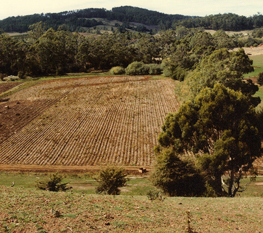
The Tasmanian Arboretum was a 47 ha farming property when purchased in 1986. The Eugenana property’s conversion to an arboretum has meant the removal of internal subdivisional fencing, and the replacement of farm buildings with buildings that suit our purpose, such as the Visitor Centre.
The main site includes 12 ha of local vegetation that has undergone little disturbance, while the balance has undergone phases of conversion and revegetation as the use and its degree of intensity has changed since the 1850’s.
Past activities on the property included clearing forests, the mining and production of lime, then farming, including the diversion and channelling of Melrose creek, and the construction of a railway and tramway.
Creating a resource for future generations, while balancing biodiversity conservation, a heritage of 150 years of exploitation, a local culture of utility and the important role of education by a botanical institution, is a continuing challenge.

Before the lake
